Along with my thoughts on the process of hexmapping I want to chronicle the process by which I actually set up the Sandbox for my weird 1974 D&D campaign. For this I will be using my own tables, Welsh Piper’s hex templates, and a template that I’ve whipped up myself. I will be mapping with 30 mile world hexes, 6 mile regional hexes, and 1.2 mile local hexes because these match up the best to movement rates in my experience.
First, I used Azgaar’s World Generator until I got a continent of roughly the shape I wanted. Then, I opened the image I downloaded from the generator up into Photoshop and cropped it to fit into the hex area of the template that I created and will attach to this post. This produces a land area roughly the size of Central Europe. From there, I divided it up into countries based on what looked right off the map, this part is much more of an art form than a science.
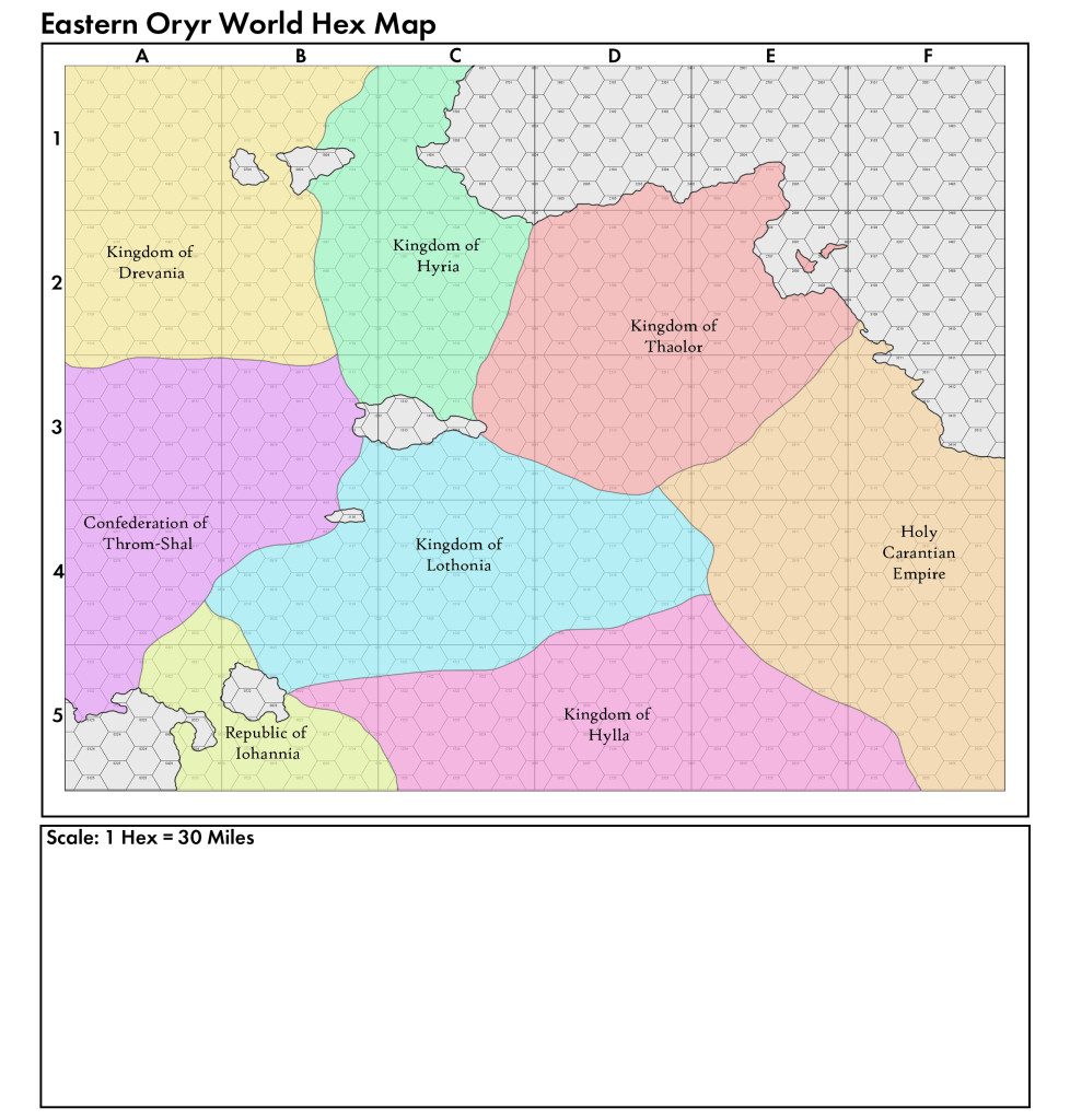
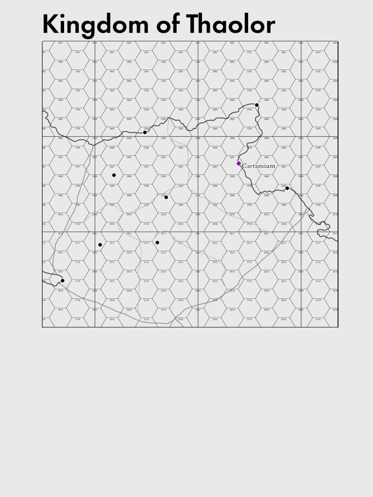
So after deciding upon the countries, their names, and their borders. I chose one nation to focus on first. As a result, this series will follow the development of the Kingdom of Thaolor. Once the focus of my efforts was decided upon, it was time to move onto the next step, which is cropping down the map to focus just on the Kingdom of Thaolor and determining its demographics. Since the vibe I was going for here was Late/Post-Roman Britain before the Anglo-Saxon migrations, so the population density of this kingdom is about 40 people per square mile.
With that information determined we were ready to go over to Welsh Piper’s Medieval Demographics Online to figure out how many cities we need to place. Plugging in our population density, a history spanning about 1,200 years of inhabitation, and the knowledge that Thaolor occupies about 85,800 square miles (a little bigger than modern day Austria) we learn that we have one massive city of about 17,000 people and eight smaller cities of about 10,000 people each. We can skip naming most of these cities now, we will come back to that but we can name the capital just as guide. The result is the below map which will serve as an excellent guide as we move forward.
Next we open up the sector template (use the hexRegional_5mileScale template from the Welsh Piper temaplates) in hexographer (this is the template we are using to drill down to a 6 mile per hex scale) and begin to fill in the terrain using the process described in my Thoughts on Hexmapping Part 1 post. I’m going to start with Sector E2. Once we finish that we can begin to stitch them together in Photoshop, which will be a time consuming but worthwhile process.
